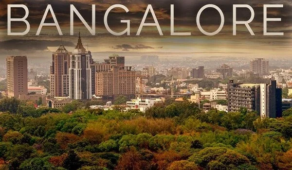
Bangalore

Featured Image of Bangalore


Bangalore is the main tech city in India and the capital of Karnataka. The city covers a total land area of 741 square kilometers. It sits at 12.9716° N latitude and 77.5946° E longitude on the map. The city runs through 8 local zones. The town splits into four main parts: North, East, South, and West. More than 3,500 tech firms operate in this city. Many young adults move here every month for work. This move keeps home demand very high across all zones. Home prices and rents go up each year. Top builders build new housing layouts on the edge of town.

New metro lines make travel to work easier and faster. Better roads and highways connect new residential areas with important parts of the city. Top builders like Sattva Group, Prestige Group, and Brigade Group are developing big housing projects in Bangalore. Buying a home in these areas can give good future value, and flat owners can also earn steady rental income.

Many professionals moving to Bangalore are helping new areas grow faster. Areas near main roads and job locations are becoming popular places to live. Buyers can get good property growth and regular rental demand in these locations. New apartments offer modern amenities, safety, and more open spaces for a comfortable lifestyle. Better roads and infrastructure projects are also helping property prices grow in many parts of the city.
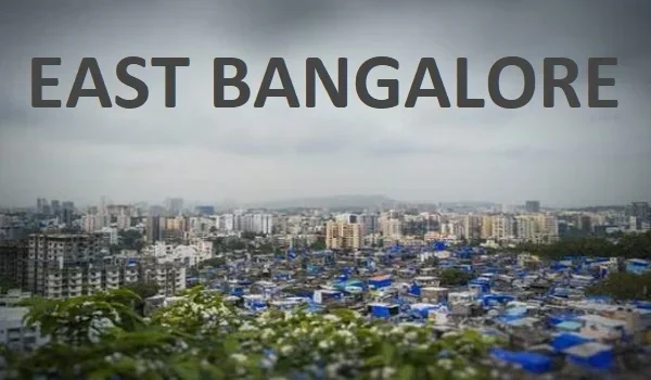
Geographic Layout and Territorial Zone Summary


Bangalore covers a total area of 741 square kilometres and is located at 12.9716° N and 77.5946° E. The city is managed through 8 administrative zones. Each part of Bangalore has its own importance. East Bangalore is known for IT companies and tech parks, while North Bangalore is growing quickly because of the airport and business developments. South Bangalore has many established residential areas, and West Bangalore is known for its industries and factories. Green spaces like Cubbon Park add to the city's beauty, while major roads such as the Outer Ring Road make travel easier across the city.

Connectivity and Transit Infrastructure


Bangalore uses roads, metro lines, and trains to move people daily.

Comprehensive Road Networks

Main roads and flyovers make daily travel easier and faster in Bangalore. They help connect different areas of the city and reduce travel time for people.

  • NICE Road: This 111-kilometer road connects important areas in South and West Bangalore and helps reduce travel time.
  • Outer Ring Road: It connects areas like Hebbal and Silk Board and supports a large number of daily commuters.
  • Electronic City Flyover: This flyover helps reduce traffic on busy roads and makes travel to Electronic City faster.
  • Airport Highway: National Highway 44 links the city center to the airport.

Metro Rail System Operations

Namma Metro provides fast and easy travel across Bangalore with its growing network of metro lines. It helps people reach different parts of the city quickly and reduces daily travel time.

  • Interchange Center: Majestic Station links the Purple Line and Green Line.
  • Yellow Line Route: The Yellow Line connects important areas in South Bangalore, including Electronic City, making travel easier for office workers.
  • Blue Line Extension: The Blue Line will improve connectivity between the Outer Ring Road tech areas and Kempegowda International Airport. It will make airport travel faster and more convenient.

Airport and Railway Hub Connections

Bangalore has good air and train connectivity, making travel easy to other cities and countries.

  • Air Access: Kempegowda International Airport offers daily flights and helps people travel quickly to different destinations.
  • Rail Hubs: Stations like KSR Bengaluru City, Yesvantpur, and SMVT connect Bangalore with many parts of India through regular train services.

Rental Income Opportunities


Thousands of professionals move to Bangalore every year, which keeps rental demand high in many areas. Locations near IT parks and business hubs usually have a steady demand for rental homes. This is a major benefit for investors as they can earn regular rental income while their property value increases over time.

IT Hubs, Tech Parks, and Employment Centers


Bangalore is India's main tech hub with over 3,500 company offices.

East Bangalore and Whitefield Enclaves

Whitefield serves as the central tech park zone of East Bangalore.

  • Key Business Parks: Includes International Tech Park Bangalore (ITPB), Manyata Tech Park, and Prestige Tech Park.
  • Workforce Impact: High office worker numbers keep local flat rent demand very strong.

North and South Tech Corridors

Electronic City in South Bangalore and Devanahalli in North Bangalore are important job hubs.

  • Electronic City: It is a large IT area spread across 330 acres and is home to major companies like Infosys and Wipro.
  • Northern Corridor: Devanahalli is growing fast because of the KIADB Aerospace Park and its location near the airport.

Educational Institutions, Healthcare, and Lifestyle Hubs


Bangalore offers top schools, big hospitals, and modern shopping malls for local families.

Elite Schools and Universities

Top colleges and international schools attract many students to Bangalore every year.

  • Top Colleges: Bangalore has well-known institutes like IISc and IIM Bangalore for higher education.
  • Primary Schools: Schools like National Public School, Greenwood High, and TISB provide quality education for children.

Healthcare Units and Shopping Malls

Major hospitals and modern retail malls support local residential areas.

  • Hospitals: Apollo Hospitals, Fortis Healthcare, and Narayana Health give top care.
  • Retail Malls: Phoenix Marketcity, Orion Mall, and Nexus Mall offer shop and food options.

Real Estate Trends and Locality Pricing


Home values in Bangalore rise steadily near active metro lines and office hubs.

Zone / Locality Average Purchase Price (per sq. ft.) Average Monthly Rent (2 BHK) Key Growth Drivers
Whitefield (East) Rs 9,500 - Rs 14,500 Rs 30,000 - Rs 45,000 Purple Line metro, active IT parks
Devanahalli (North) Rs 6,000 - Rs 9,000 Rs 18,000 - Rs 28,000 Close to airport, aerospace park
Electronic City (South) Rs 5,500 - Rs 8,500 Rs 20,000 - Rs 32,000 Yellow Line metro, cheap flats
Tumkur Road (West) Rs 6,500 - Rs 10,000 Rs 22,000 - Rs 35,000 Factory hubs, new highway links

Prominent Housing Projects in 2026


Top builders construct modern flat communities with verified launch dates and RERA details.

  • Sattva Vasuvi (Marathahalli - Sarjapur Road): Sattva Vasuvi is a top 13-acre project pre-launched on June 10, 2026, by Sattva Group. The public launch date is October 15, 2026. The project holds 920 flats across 9 towers. Unit sizes for Sattva Vasuvi range from 1 to 4 BHK (450 to 2,250 sq. ft.). The RERA number is currently pending approval. Official possession starts on December 31, 2031.
  • Brigade Golden Heights (Budigere Road): Brigade Golden Heights covers 10.75 acres in East Bangalore. This project launched in early 2026. Target home possession is set for March 2031.
  • Brigade Granada (Whitefield-Hoskote Road): Brigade Granada launched in May 2026 across 20 acres with 14 towers. Official RERA registration is pending. Possession is planned for December 2031.
  • Prestige Battersea: Prestige Battersea is an upcoming pre-launch flat project by Prestige Group near key job hubs.

FAQs


1. What is the difference between Bengaluru vs Bangalore?

Bengaluru is the official local name adopted in 2014, while Bangalore is the common English name.

2. How do I find the exact Bangalore distance to the airport?

The Bangalore distance from MG Road in the center to Kempegowda International Airport is 35 kilometers.

3. Which state capital is Bangalore?

Bangalore is the official state capital city of Karnataka in South India.

4. What is the standard Bangalore PIN code range?

The Bangalore PIN code range runs from 560001 in central zones to 560114 in outer areas.

5. What is the historical Bangalore meaning?

The Bangalore meaning comes from Benda-Kaalu-Uru, which means the town of boiled beans in Kannada.

6. How can I read a Bangalore map for suburban directions?

You can examine a Bangalore map by checking the four main zones: North, East, South, and West.

7. How do I navigate Bangalore directions when traveling across the Bangalore city area?

Navigating Bangalore directions across the Bangalore city area is easy using Outer Ring Road and metro lines.

Sattva Vasuvi Blog


Enquiry
Enquire Now